Crete is one of the 13 Greek regions Greece is divided. It forms the largest island in Greece and the second largest in the East Mediterranean(after Cyprus), with a population of 800,000. The island has an elongated shape : it spans 260 km from east to west and 60 km at its widest, although the island is narrower at certain points, such as in the region close to Ierapetra , where it reaches a width of only 12 km.
Crete covers an area of 8,336 km², with a coastline of 1046 km ; to the north it broaches the Sea of Crete (Greek: Κρητικό Πέλαγος) ; to the south the Libyan Sea ; in the west the Myrtoan Sea, and toward the east the Karpathion Sea. It lies approximately 160 km south of the Greek mainland.
Crete is extremely mountainous, and its character is defined by a high mountain range crossing from West to East, formed by three different groups of mountains. These are:
a) White Mountains or Lefka Ori (2,452 m), b) Idi range (Psiloritis (35.18° N 24.82° E) 2,456 m) c) Dikti mountains (2,148 m) d) Kedros (1,777 m) e) Thripti (1,489 m).
The island of Crete is a periphery of Greece, consisting of four prefectures (in Greek: νομοί):
Chania – Chania town – Paleochora – Samaria Gorge–Heraklion – Heraklion city – Hersonissos – Malia – Matala – Knossos-Lasithi – Agios Nikolaos – Lasithi plateau- Ierapetra – Vai palm beach-Rethymnon – Rethymnon town – Spili – Preveli – Anogia village
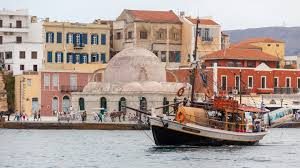
Chania is a beautiful city. The most beautiful in Crete, one might even say in the whole of Greece. It is the second largest city of Crete and the capital of the Chania Prefecture. It lies along the north coast of the island, about 70 km west of Rethymno and 145 km west of Heraklion. You could say that Chania consists of two towns, the old and the new, which coexist in a harmonious whole.
The new Chania town embraces the old and spreads outwards ever wider. Its layout is fairly good near the center and it’s easy to find your way around. Unfortunately, this changes in the suburbs, where it’s easy to get lost. The heart of Chania is still the old town, with its narrow, labyrinthine alleyways and listed buildings dating from different periods, where you can enjoy romantic strolls. Many of these buildings have been turned into small hotels, restaurants, shops or homes.
Paleochora is a small town in Chania prefecture. Paleochora is located 77 km south of Chania, at the southwest coastline of Crete and it’s built on a small peninsula of 400m width and 700m length. The Libyan Sea wets its coasts of 11km length. It is the capital town of the municipality of Pelekanos, in the province of Selino and its population is 2.213 (2001 census source). Palaiochora’s economy is based in tourism and in agriculture (mainly tomatoes cultivated in glass-houses and also the production of olive-oil).
It is a relaxing holiday place since early 70’s, when it was a famous hippies’ center. Nowadays Paleochora is one of the fastest growing tourist towns Crete. Paleochora has crystal clear waters, well-organized beaches and beautiful isolated little anchorages.
Visitors can find many hotels, restaurants, taverns, cafes, bars and nightclubs. Palaiochora has all the facilities such as bank branches, a post office, central telephone office, health center, doctor offices, dentists, pharmacies, police station, coast guard and customs office and many kind of stores. There are ferry boats, connecting Paleochora with Sougia, Agia Roumeli, Loutro, Chora Sfakion and Gavdos. Paleochora is built on the ruins of the ancient city of Kalamydi. There are also many Byzantine churches in the area.
Samariá Gorge is a national park on the island of Crete, and a major tourist attraction of the island.
It was created by a small river running between the White Mountains and Mt. Volakias. There are a number of other gorges in the White Mountains. While some say that the gorge is 18 km long, this distance refers to the distance between the settlement of Omalos on the northern side of the plateau and the village of Agia Roumeli.
In fact, the gorge is 16km long, starting at an altitude of 1,250m at the northern entrance, and ending at the shores of the Libyan Sea in Agia Roumeli.
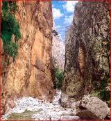
The walk through Samaria National Park is 13 km long, but you have to walk another three km to Agia Roumeli from the park exit, making the hike 16 km. The most famous part of the gorge is the stretch known as the Iron Gates, where the sides of the gorge close in to a width of only four meters and soar up to a height of 500 m. The village of Samariá lies just inside the gorge. It was finally abandoned by the last remaining inhabitants in 1962 to make way for the park. The village and the gorge take their names from the village’s ancient church, Óssia María -“Saint Mary”.
A “must” for visitors to Crete is to complete the walk down the gorge from the Omalos plateau to Agia Roumeli on the Libyan Sea, at which point tourists sail to the nearby village of Hora Sfakion and catch a coach back to Chania. The walk takes 4-7 hours and can be strenuous, especially at the height of summer.
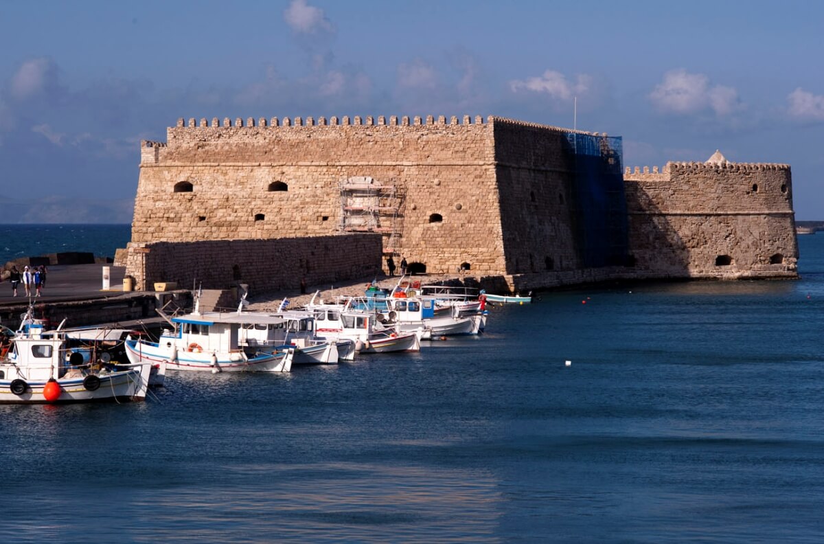
Heraklion is the largest city and capital of Crete. It is also the fourth largest city in Greece. Its name is also spelled Herakleion, a transliteration of the ancient Greek and Katharevousa name, Ἡράκλειον, or Iraklio, among other variants. For centuries it was known as Candia, a Venetian adaptation of the earlier Greek name Χάνδαξ or Χάνδακας, which in turn came from the Arabic rabḍ al-ḫandaq. Under the Ottoman Empire, it was called Turkish: Kandiye).
In the local vernacular, it is often called Κάστρο (Kástro, “castle”) and its inhabitants Καστρινοί (Kastrinoí, “castle dwellers”).
Heraklion is the capital of Heraklion Prefecture, with an international airport named after the writer Nikos Kazantzakis. The ruins of Knossos, which were excavated and restored by Arthur Evans, are nearby.
| Limenas Chersonisou is a town in the north of Crete, on the Mediterranean. This community is about 25 kilometers east of Heraklion and west of Agios Nikolaos. What is usually called Hersonissos is in fact its peninsula and harbour. It is part of the Heraklion Prefecture just 25 klm from the Heraklion airport and 27 klm from the Heraklion port. |
Hersonissos is oriented towards tourism industry, and popular with Dutch, British and German nationals. At the end of it there are big hotels and the Star Beach with slides, bars, pools, games, bungie jump, go-karts, like a day time club. There is also a lot to do for children. In the main street there are many souvenir shops, as well as other shops and restaurants, some of which are near the sea. 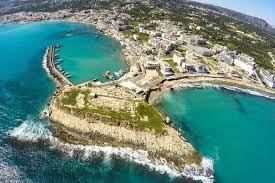 There is also a small aquarium called Aquaworld featuring local sea life and reptiles, which the children can hold. Nightlife is also important, and feature discos, clubs, bars and pubs. One can take a sight-seeing train that runs down the main street along the sea, and provides access to the surroundings of Chersonissos. People who like to rest and sunbath on holiday can enjoy Hersonissos, for it has beautiful beaches, and excursions to other places on Crete can be made from here as well. Like many communities on Crete, the local economy is not only based on tourism, but also on agriculture. In the fall, when most of the tourists have left, many people normally employed in the tourism industry earn money with the olive harvest |
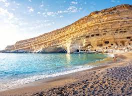
Matala has something for everyone. Although it has become a popular tourist destination it still retains the charm and character of the quiet fishing village it started as at the beginning of the 20th-century, and the laid-back lifestyle of the hippies of the 60’s and 70’s lives on. Half the beach is fringed by tamarisk trees, leading the eye on to impressive formations of sandstone rock cliffs with their famous caves sliding into the sea at an odd angle, creating one of the most unusual beachscapes on the island.
A masseuse sets up a tent on the beach, and cafés and tavernas have terraces overlooking the beach and out to sea … after a day on the beach or exploring the village you can sit and watch the sunset over the Libyan Sea, looking out over the islands towards Africa.
There have been many pages of history here. Nobody knows quite who started caves but it seems likely that they were first hollowed out as Roman or early Christian tombs. There are other ruins at the eastern end of the village and if you go snorkelling in the clear waters of Messara Bay there are ancient ruins to be seen in the depths, while sometimes the wind blows hot and sandy from Africa …
Matala it is one of just over 400 beaches in Greece that have been awarded a Blue Flag.
This exclusive eco-label is given to beaches that offer cleanliness and safe bathing areas and has strict criteria dealing with water quality, environmental management and safety. There is a lifeguard and first aid facilities, as well as toilets and a shower.
Near the beach are opportunities for learning about environmental projects, such as with Archelon, the Sea Turtle Protection Society of Greece, and the beaches of Matala, Kommos and Red Beach come under Natura 2000, a European Union network of nature protection areas established to assure the long-term survival of Europe’s most valuable and threatened species and habitats.
At the beach there are sport facilities as well as activities for children, and if you would like to go further afield you can also rent a car, bicycles and motorbikes. Yet all this is only 75 km from Iraklion
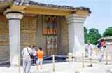
Knossos, also spelled knossus, city in ancient Crete, capital of the legendary king Minos, and the principal centre of the Minoan, the earliest of the Aegean civilizations (see Minoan civilization). The site of Knossos stands on a knoll between the confluence of two streams and is located about 5 miles (8 km) inland from Crete’s northern coast.
Excavations were begun at Knossos under Sir Arthur Evans in 1900 and revealed a palace and surrounding buildings that were the centre of a sophisticated Bronze Age culture that dominated the Aegean between about 1600 and 1400 bc.
The first human inhabitants of Knossos probably came there from Anatolia in the 7th millennium bc and established an agricultural society based on wheat and livestock raising. At the beginning of the Early Minoan period (3000–2000 bc) they began using bronze and making glazed pottery, engraved seals, and gold jewelry. A hieroglyphic script was invented, and trade with the Egyptians was undertaken.
The first palace at Knossos was built at the beginning of the Middle Minoan period (2000–1580 bc). It consisted of isolated structures built around a rectangular court. Knossos produced fine polychrome pottery on a black glazed ground during this period. About 1720 bc a destructive earthquake leveled most of Knossos.
The palace was rebuilt, this time with extensive colonnades and flights of stairs connecting the different buildings on the hilly site. The remains of this palace occupy the excavated site in the present day. The administrative and ceremonial quarters of the palace were on the west side of the central court, and the throne room in this area still contains the gypsum chair in which sat the kings of Knossos.
This area of the palace also had long narrow basement rooms that served as storage magazines for wheat, oil, and treasure. Workshops were located on the northeast side of the central court, while residences were situated in the southeastern section. An elaborate system of drains, conduits, and pipes provided water and sanitation for the palace, and the whole urban complex was connected to other Cretan towns and ports by paved roads.
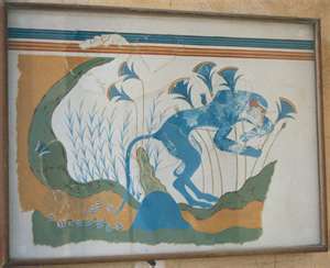
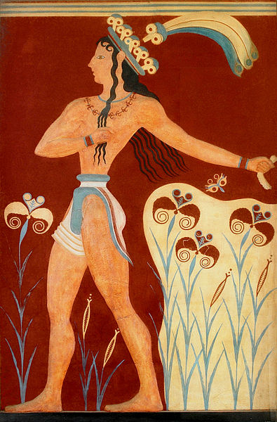
The art of Minoan fresco painting reached its zenith at this time, with scenes of dancing, sports, and dolphins done in a naturalistic style. The Minoans also replaced their hieroglyphic script with a linear script known as Linear A.
About 1580 bc Minoan culture and influence began to be extended to mainland Greece, where it was further developed and emerged as the culture known as Mycenaean.
The Mycenaeans, in turn, achieved control over Knossos sometime in the 15th century bc; the Linear A script was replaced by another script, Linear B, which is identical to that used at Mycenae and is most generally deemed the prototype of Greek.
Detailed administrative records in Linear B found at Knossos indicate that at this time the city’s Mycenaean rulers controlled much of central and western Crete.
Some time after about 1400 bc, what Evans called the “Last Palace” of Knossos was destroyed by a fire of uncertain origin, and fires destroyed many other Cretan settlements at this time.
Knossos was reduced henceforth to the status of a mere town, and the political focus of the Aegean world shifted to Mycenae on the Greek mainland. Knossos continued to be inhabited through the subsequent centuries, though on a much-reduced scale.
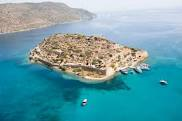
Lasithi is the easternmost prefecture on the island of Crete, to the east of the prefecture of Heraklion. Its capital is Agios Nikolaos, the other major towns being Ierapetra, Sitia and Neapoli. The mountains include the Dikte to the west and the Sitia Mountains to the east. The Sea of Crete lies to the north and the Libyan Sea to the south.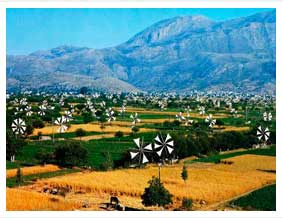 To the east of the village of Elounda lies the island of Spinalonga, formerly a Venetian fortress and a leper colony. On the foot of Mount Dikti lies the Lasithi Plateau, famous for its windmills. Vai is well-known for its datepalm forest. Thanks to stunning beaches and its mild climate year-long, Lasithi attracts many tourists. Mass tourism is served by places like Vai, Agios Nikolaos and the island of Chrissi. More off-beat tourism can be found in villages on the south coast like Myrtos, Makrys Gialos or Makrigialos, Xerokambos and Koutsouras. The prefecture is home to a number of ancient remains. Vasiliki, Fournu Korfi, Pyrgos, Zakros and Gournia are ruins of Minoan date, Lato and Itanos were Doric towns. |
| Lasithi Plateau is a large , scenic plain located in the Lasithi prefecture in eastern Crete, Greece. It is approximately 70 km from Heraklion and lies at an average altitude of 840 m, which makes it one of the few permanently inhabited areas of such altitude around the Mediterranean.Winters can be very harsh and snow on the plain and surrounding mountains often persists until mid spring |
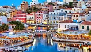
Agios Nikolaos is the capital of the nomos (province) of Lasithi, and sits partially upon the ruins of the ancient city of Lato pros Kamara. Agios Nikolaos is probably best known as a tourist town that serves as a hub to the twenty or so small villages and farms that make up that part of Lassithi.
Tourist attractions include the small lagoon Lake Voulismeni, small beaches in the town, the tiny island Agioi Pantes, the archaeological museum, the local flora exhibition “Iris” and numerous fairs. Tourism is mainly west European with Greek tourism concentrating in mid August. The lagoon features a small park with a trail, traditional fishing boats, ducks, pigeons, an amphitheatre and many cafès.
Elounda is a small fishing town on the bay of Elounda, on the northern coast of the island.Elounda is also the closest major town to the former leper colony of Spinalonga, located on an island officially named Kalydon located at the entrance of the Bay of Elounda, a lake-like body of water enclosed by mainland Crete and the peninsula of Spinalonga Elounda is widely considered the “most luxurious resort” in Greece, due to the many 5-star hotels located south of town, set in their own grounds.
Ierapetra. The town of Ierapetra is located on the south coast of Crete, along the beach of Ierapetra Bay. It lies south of Agios Nikolaos and southwest of Sitia and is an important regional centre. With its 15,400 inhabitants (2001) it is the most populous town in the prefecture of Lasithi, and the fourth town of Crete. Ierapetra is popularly known as the southernmost town of Europe, nicknamed “bride of the Libyan Sea” because of its position as only town on the south coast of Crete.
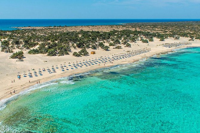
Chrissi (Golden) or Gaidhouronisi (Donkey Island) is an uninhabited island some twelve kilometers off the coast of the town of Ierapetra. It is five kilometers long and on average one kilometer wide. The island’s average height above sea level is ten meters; Kefala, the highest point of the island, is 31 meters above sea level.
The island is renowned for its white beaches, sand dunes and forest of pines and junipers. The western tip of the island has some remains of past settlement: a few Minoan ruins and a 13th century chapel dedicated to Agios Nikolaos (Saint Nicholas). It was inhabited into Byzantine times. The main sources of wealth were fishing, salt export, and the export of porphyra (Tyrian purple), a scarlet dye made from shells.
After the Byzantine period the island was abandoned, although later it was used as a hideout. owadays the island is protected as an “area of intense natural beauty”. Especially in summer, the island attracts many tourists. As camping is forbidden on the island, only day trips are possible. Ferries leave the quay at Ierapetra daily at 10 A.M. and return at 5 P.M.
Visitors are not allowed to roam freely over the island, but only on designated paths and some beaches close to the eastern tip of the island. There is a small tavern at the ferry landing. 700 meters to the east of Chrissi lies the rocky islet of Mikronisi (Small Island).
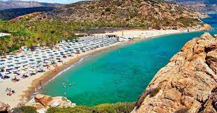
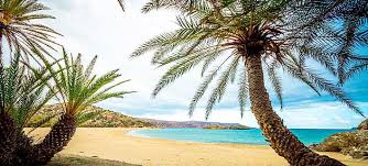
Vai palm beach is one of the largest attractions of the Mediterranean island of Crete. It features the largest natural palm forest in Europe, made up of palm tree Phoenix Theophrastii.
For tourism Vai was discovered at the end of the 1970s by the last Hippies who fled the hot-spots Matala and Preveli. At the beginning of the 1980s Vai was full of backpacker tourists from the whole world, leading to a mixture of chaotic campground and garbage dump. Vai was enclosed and declared as a protected area. The unique forest recovered, the beach became clean.
The palm beach, which belongs to the Monastery Toplou, is the touristic center of East Crete, with thousands of visitors each year. Vai lies close to Palekastro and Sitia
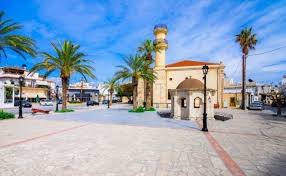
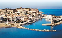
Rethymnon, is a city of approximately 45,000 people, it is the capital of Rethymno Prefecture in the island of Crete. It was built in antiquity, even though it has never been a competitive Minoan center. It was, however, strong enough to mint its own coins and maintain a mild urban growth.
One of these coins is today depicted as the crest of the town with two dolphins in a circle. The town still maintains its old aristocratic appearance, with its buildings dating from the 16th century, arched doorways, stone staircases, Byzantine and Hellenic-Roman remains, small Venetian harbor and narrow streets.
Sights :The Venetian Loggia, The Fortezza castle, Rithymna, Rimondi fountain, Neratzes mosque, Kara Mousa Pasa Mosque also a venetian monastery, Folklore & history museum, The Archaeological museum,
The municipal gardens are ideal for those in search of shade and tranquillity.
Situated some 30km South of the town of Rethymno, and approximately in the middle of the island of Crete, Spili has everything for the visitor who wants to experience ”natural Crete”. Mount Vorizi which hovers over the town is impressive, but wait until you walk up the side streets of this village to be really impressed. The cobbled streets and flowering shrubs are a photographers dream. In the centre of the village is a Venetian fountain with a long row of 19 stone lions heads splashing welcome cool water into the trough below.
Above this starts the climb through the beautifully quaint village streets with their flowered balconies, arches, and cobbles.
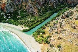
Preveli the famous palm tree forest in Limni, Preveli PREVELI. Preveli is famous for its palm beach and because of the monastery which was erected at the end of the 16th century. From Agia Galini daily boat trips are leaving from the harbour to go to Prevely. You can reach Prevely also by car, but then you have to walk down the mountain from the parking place near the monastery. Since they made stairs to walk down its save to do so.
The view is gorgeous, its a fascinating place, which you really must visit if you have the opportunity. If you want to visit the monastery, please note that you wear descent clothes.
